


In 2026, the Himalayas are no longer a seasonal theater of operations. They are a zone of permanent activation.
The Line of Actual Control (LAC) has settled into a tense but structured equilibrium. While the intense standoffs of the early 2020s have eased, the region is not relaxed—both India and China maintain elevated troop levels, robust infrastructure, and dense surveillance.
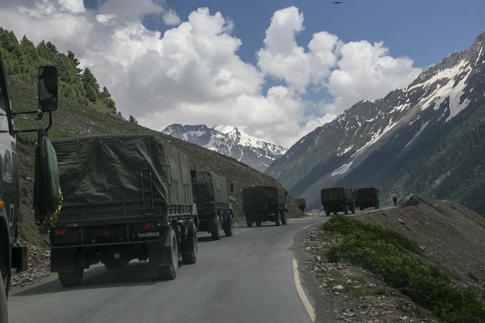
For India, this marks a doctrinal shift. The traditional model of reactive mobilization has given way to sustained readiness. Logistics chains, once seasonal, are now engineered for permanence. Ammunition depots, fuel reserves, prefabricated shelters, and tunnel networks have fundamentally reshaped the depth and endurance of forward deployments.
Compressed Timelines and Strategic Mobility
The most striking transformation along the northern frontier is the compression of mobilization timelines. Roads, bridges, and tunnel systems constructed over the past five years now allow rapid movement of armor and artillery to high-altitude sectors. Airlift coordination has improved, with forward airbases reinforced for all-weather operations. In modern Himalayan deterrence, speed often equals leverage: the quicker the reinforcement, the higher the bargaining advantage during crises.
China mirrors this approach, with forward deployments and logistics networks that reduce reaction time. This new reality turns localized friction into a potentially faster-scaling challenge, making disciplined command and clear communication channels essential.
Sector-Wise Dynamics
Kailash Range and Demchok (Ladakh)
Glacial valleys and rugged terrain define these sectors. Infrastructure gaps have historically constrained deployment. Recent projects—extended all-weather roads, prefabricated shelters, and forward observation posts—have reduced response times. ISR coverage now includes drone reconnaissance integrated with satellite data, providing near-real-time situational awareness.
Nathu La and Sikkim
Narrow ridges and dense forest create a complex operational environment. India has enhanced road connectivity and forward airbases while increasing high-altitude training for troops. Sensor reach and communications resilience are critical, as rapid Chinese reinforcement along this sector is feasible via improved logistics.
Eastern Arunachal Pradesh
River-crossing bridges, upgraded roads, and helicopter landing zones now support rotational deployments. The region’s challenging climate and remote valleys make infrastructure development slow and costly, but indispensable for sustained deterrence.
Technology and Air Power Integration
Air superiority is central to modern Himalayan strategy. Forward airbases now support all-weather operations, while air defense coverage integrates surface-to-air systems. High-altitude pilot training, engine performance optimization, and airlift drills have become operational imperatives.
ISR modernization has transformed visibility along the frontier. Small UAVs provide tactical intelligence, loitering munitions are part of operational planning assumptions, and electronic warfare units operate both defensively and offensively. In this terrain, situational transparency reduces the risk of surprise, but it accelerates escalation, compressing decision-making windows.
The Pakistan Factor: Western Frontier Complexity
On the western frontier, India faces a different but equally evolving challenge. Pakistan remains below the threshold of conventional conflict, but low-cost UAVs and drone intrusions now add technological layers to longstanding border tensions. Counter-drone systems—including radar integration, signal jamming, and kinetic interception—are increasingly deployed forward to deny persistent observation and surveillance.
Infrastructure as Deterrence
Infrastructure is no longer merely facilitative—it is strategic. Tunnels through mountain passes, all-weather roads, expanded airstrips, and hardened shelters now serve as tangible signals of intent. Yet, faster access and mobility come with trade-offs: compressed political decision-making windows and escalatory risks. Military hotlines and diplomatic channels operate alongside permanent deployments, but must adapt to this new tempo.
Human, Environmental, and Climate Considerations
High-altitude operations remain constrained by the human factor. Acclimatization, oxygen management, and medical readiness are decisive. Rotational troop policies prevent fatigue, while mental health and high-altitude skill retention are now integral to operational sustainability.
Climate remains an unpredictable variable. Avalanches, landslides, glacial melt, and extreme weather test infrastructure resilience and operational continuity. The Indian military increasingly employs climate-resilient construction, from reinforced tunnels to all-weather roads, ensuring sustainability under harsh conditions.
Information Management and Strategic Communication
Persistent deployment extends beyond physical presence. Social media amplification of localized incidents can create rapid national-level pressure. India now emphasizes strategic communication as part of overall border stability—managing troop movements, public narratives, and cross-border perception to prevent inadvertent escalation.
The Long-Term Horizon
The Himalayan frontier shows little sign of returning to lighter deployment levels. Both sides are comfortable with an elevated posture, signaling deterrence through readiness rather than conflict. India’s strategy is pragmatic: maintain credible defense while avoiding unnecessary escalation. Sustained funding, modernization of surveillance and mobility assets, and disciplined rotational policies are critical.
In 2026, the mountains are no longer remote buffers. They are active strategic zones. Success on this frontier will depend less on dramatic clashes than on endurance, technological integration, and crisis management under compressed timelines. Strategic complacency is costlier than permanent preparedness—a reality India has internalized.
