


India’s northern frontier — spanning Ladakh, Uttarakhand, Himachal Pradesh and Sikkim — is no longer a peripheral geography. It is a high-altitude logistics theatre where deterrence credibility is directly tied to infrastructure survivability.
Altitudes range from 9,000 to over 18,000 feet. Construction windows compress to 4–6 months annually. Freeze–thaw cycles fracture pavement. Glacial melt redefines river morphology. Monsoon destabilization in the central Himalayas generates recurring landslides. Infrastructure here is not developmental — it is operational.
Under the India–China Border Roads (ICBR) framework, largely executed by the Border Roads Organisation, India has accelerated construction since 2020. Yet the frontier’s next phase is no longer about access. It is about redundancy, throughput, and survivability under disruption.
Sectoral Overview
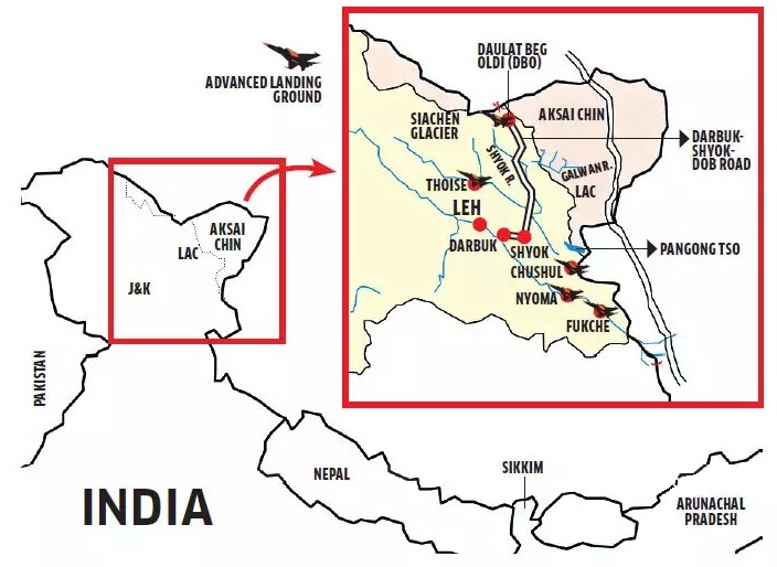
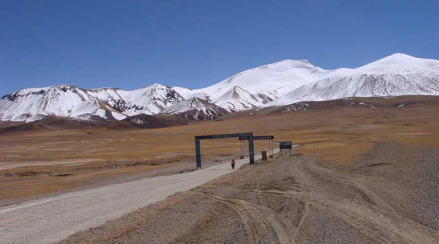
Eastern Ladakh: Linear Strength, Limited Redundancy

Yet Ladakh remains structurally linear:
-
Long stretches of the DS-DBO alignment run parallel to the Shyok River.
-
Lateral east–west connectors remain limited.
-
Airlift remains concentrated at a few critical nodes.
Mobility exists. Redundancy does not yet scale proportionally.
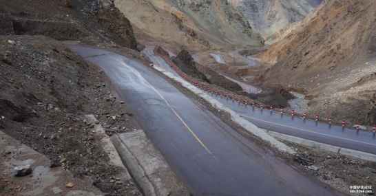
Uttarakhand Axis: Connectivity Under Geological Stress


Unlike Ladakh’s cold desert plateau, Uttarakhand sits in young fold mountains with high rainfall.
Key constraints:
-
Landslide recurrence cycles reduce annual availability days.
-
Bridge load classifications vary; sustained heavy armor mobility remains constrained in segments.
-
Valley geometry restricts logistics node depth.
Here, the limiting variable is durability, not access.
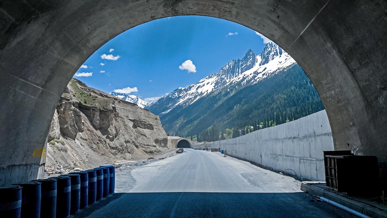
Sikkim & Nathu La: Narrow Corridor Dynamics
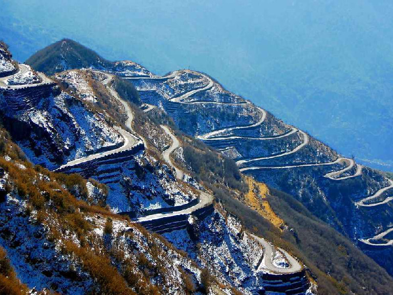
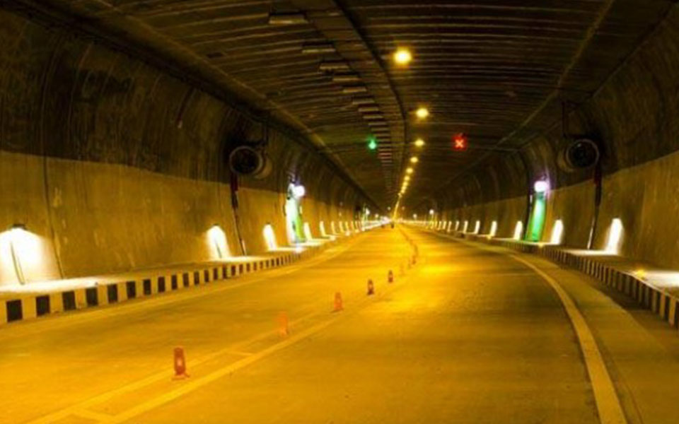

The Nathu La Pass axis remains a historically active corridor. The Theng Tunnel improves localized reliability, but broader corridor redundancy remains limited.
Disruption along the Gangtok–Nathu La route has immediate operational impact due to limited parallel alignments.
Quantified Infrastructure Scoring Model (0–5 Weighted)
To move beyond qualitative assessment, the following weighted scoring model evaluates infrastructure maturity across sectors.
Parameters & Weights
Parameter |
Weight |
|---|---|
Primary Access Quality |
15% |
Redundancy (Parallel Routes) |
20% |
Lateral Connectivity |
15% |
Tunnelization & All-Weather Reliability |
15% |
Heavy-Lift Bridge Capacity |
10% |
Airfield/ALG Dispersal |
10% |
Logistics Node Depth |
10% |
Energy & Digital Resilience |
5% |
Score Scale:
0 = Absent
1 = Minimal
2 = Limited
3 = Functional
4 = Strong
5 = Layered & Redundant
Sectoral Weighted Scores (Indian Side)
Sector |
Weighted Score (0–5) |
|---|---|
Eastern Ladakh |
3.1 |
Uttarakhand Axis |
2.6 |
Sikkim / Nathu La |
2.9 |
Interpretation
-
Ladakh scores highest due to post-2020 acceleration but remains constrained by redundancy deficit.
-
Uttarakhand is connectivity-rich but resilience-poor under monsoon stress.
-
Sikkim benefits from historical connectivity yet remains corridor-dependent.
The central systemic weakness across all sectors: parallel alignments and distributed logistics depth.
72-Hour Mobilization Scenario Modelling
To assess operational elasticity, consider a 72-hour limited escalation scenario requiring:
-
Rapid reinforcement of forward brigades
-
Movement of heavy platforms
-
Fuel and ammunition surge
-
Casualty evacuation redundancy
Eastern Ladakh (Indian Side)
Strengths:
-
Functional DS-DBO spine.
-
ALG availability.
Constraints:
-
Single-axis congestion risk.
-
Limited east–west diversion options.
-
Throughput bottleneck if a key bridge is disrupted.
Assessment: Initial reinforcement achievable. Sustained high-volume throughput vulnerable to targeted disruption.
Uttarakhand Axis
Strengths:
-
Recent road expansion.
-
Proximity to central plains.
Constraints:
-
Landslide vulnerability during monsoon.
-
Bridge load variability.
-
Limited forward storage depth.
Assessment: Reinforcement feasible but seasonal unpredictability introduces risk into tempo planning.
Sikkim Axis
Strengths:
-
Established corridor.
-
Eastern air support from rear bases.
Constraints:
-
Linear approach.
-
Limited alternate alignments.
Assessment: Rapid early mobilization possible; corridor disruption rapidly degrades tempo.
Calibrated China Comparison
Infrastructure asymmetry must be assessed structurally, not rhetorically.
On the Chinese side of the LAC:
-
Plateau topography enables multi-lane highway grids.
-
Rail connectivity reaches deep into Tibet.
-
Greater dispersal of airbases.
-
Larger staging areas.
-
Extensive tunnelling and hardened facilities.
This yields higher logistics elasticity and redundancy depth.
Sector-Specific Micro-Analysis
Depsang (India) vs Aksai Chin (China)
Indian Side – Depsang Plains
-
Dependent on DS-DBO alignment.
-
High-altitude ALG at Daulat Beg Oldie.
-
Limited lateral connectors across sub-sectors.
Chinese Side – Aksai Chin
-
G219 highway provides all-weather plateau connectivity.
-
Multiple feeder roads branching toward forward positions.
-
Greater horizontal mobility due to terrain flatness.
Structural Difference:
China’s plateau grid offers route multiplicity. India’s access, while improved, remains corridor-centric.
Nathu La (India) vs Chumbi Valley (China)


Indian Side – Nathu La
-
Single principal axis from Gangtok.
-
Tunnel mitigation improving winter resilience.
-
Narrow approach geometry favors defensive depth.
Chinese Side – Chumbi Valley
-
Road network descending from plateau into valley.
-
Broader staging area near Yadong.
-
Plateau-connected logistics backbone.
Structural Difference:
China enjoys depth and staging space; India benefits from defensive elevation and choke-point control.
Updated Comparative Scoring (Broad Estimate)
Side |
Estimated Infrastructure Depth Score (0–5) |
|---|---|
India (Aggregate Northern Sectors) |
2.9 |
China (Opposite LAC Sectors) |
4.2 |
This does not imply operational superiority in all scenarios. It indicates infrastructure redundancy and bulk-lift elasticity advantage.
Structural Conclusions
The infrastructure competition across the Himalayas now operates on three axes:
-
Redundancy depth
-
Throughput sustainability
-
Survivability under disruption
India has substantially reduced its historical access deficit. It has narrowed — but not eliminated — the redundancy and bulk-mobility gap.
The next phase must prioritize:
-
Parallel alignments
-
Rail feasibility into Ladakh
-
Hardened air infrastructure
-
Distributed logistics nodes
-
Layered communications and energy micro-grids
-
Tunnel network scaling
The northern frontier is no longer defined by road absence. It is defined by the ability to absorb disruption without degrading operational tempo.
The transition required now is from construction-driven expansion to systems-engineered resilience.
