


India does not face a shortage of weapons. It faces a shortage of coherence.
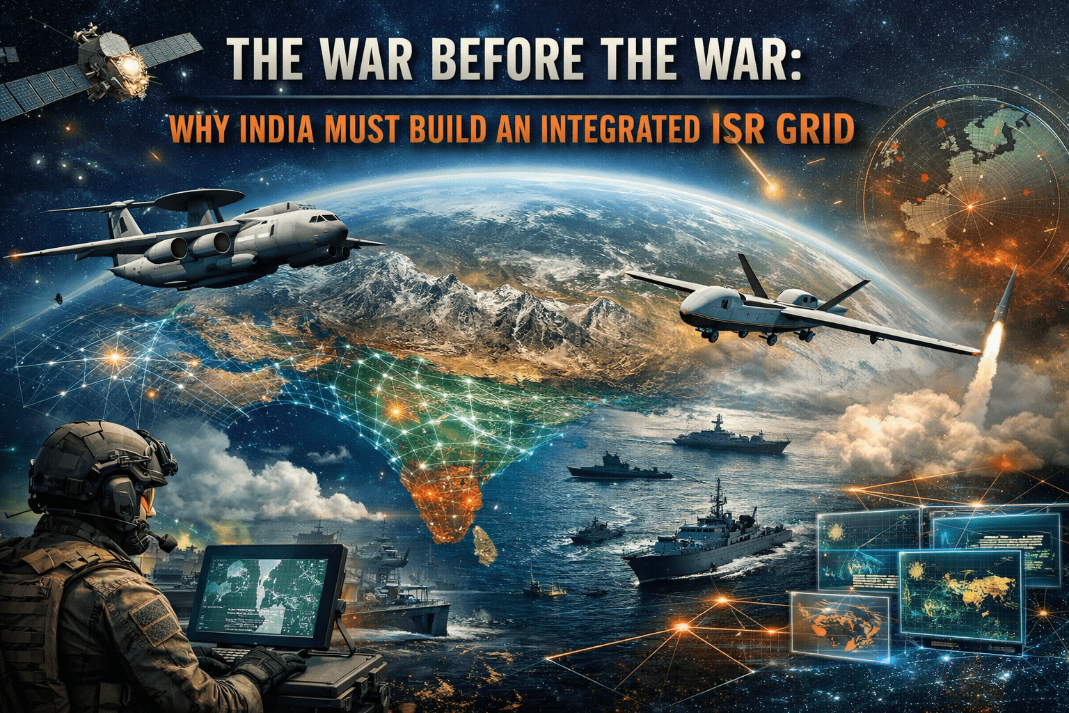
The uncomfortable reality is that India can strike farther than ever before. It can launch precision munitions, deploy long endurance drones, operate advanced maritime patrol aircraft, and maintain credible missile forces. Yet the system that connects detection to decision and decision to action remains unevenly stitched together. Sensors exist. Shooters exist. The connective logic that fuses them into a single operational brain does not fully exist.
An integrated ISR grid is not an optional modernization project. It is the foundation upon which deterrence credibility now rests.
The central question is no longer how far India can shoot. It is how quickly and accurately India can see.
From Platform Accumulation to System Warfare
The Indo-Pacific is shifting toward system level competition. China’s military reforms since 2015 have emphasized theater commands, cross domain data fusion, and space enabled targeting cycles. The People’s Liberation Army does not treat ISR as a support function. It treats it as the central nervous system of warfare.
India’s modernization trajectory has been different. It has understandably focused on filling capability gaps. More fighters. More artillery. More submarines. These were necessary corrections.
But platform accumulation without deep integration creates diminishing returns. A fighter equipped with advanced missiles cannot exploit their full potential without real time, resilient targeting data. A submarine’s survivability is compromised if adversaries can track its movements while it operates on fragmented awareness.
System warfare compresses decision timelines. The side that detects patterns early, classifies threats accurately, and distributes targeting data seamlessly across domains shapes escalation dynamics before kinetic exchanges begin.
India’s current architecture remains service heavy. The Indian Air Force operates airborne early warning platforms. The Indian Navy fields maritime patrol aircraft and coastal radar chains. The Army runs its own tactical surveillance grid along the northern borders. Space based reconnaissance assets exist under dedicated agencies. Each node performs its task.
What remains underdeveloped is persistent, automated, cross service data fusion at scale.
The Northern Theatre: Escalation Begins With Logistics
The Line of Actual Control is not a static front. It is a logistics competition disguised as territorial friction.
Since 2020, the most consequential developments along the Himalayas have not been firefights. They have been roads, forward airstrips, depots, and rotational troop deployments. These are detectable activities. The issue is not whether India can collect the data. It is whether that data can be integrated in near real time across agencies and commands to produce predictive insight.
An integrated ISR grid would allow India to track infrastructure expansion patterns, correlate satellite imagery with signals intelligence, and model mobilization cycles. The value lies not in raw imagery but in fusion and interpretation.
Escalation control depends on anticipation. If India can identify force build ups early, it can pre position forces or open diplomatic channels before tactical incidents spiral.
Most commentary reduces border management to troop numbers and equipment induction. The more decisive variable is visibility. Without persistent integrated awareness, India remains reactive to adversary tempo.
Maritime Domain Awareness: The Indian Ocean Is No Longer Quiet
The Indian Ocean is transitioning from a relatively permissive space to a contested data environment.
Chinese research vessels, ostensibly civilian survey ships, operate with increasing frequency. Submarine patrols, intelligence collection missions, and dual use port access agreements form a layered maritime presence. None of this is overtly hostile. All of it shapes the battlespace.
India already possesses significant maritime ISR assets. Long range patrol aircraft, coastal radars, and satellite monitoring provide valuable coverage. The weakness lies in fragmentation and limited integration with allied feeds.
An integrated ISR grid would fuse space based tracking, acoustic data, maritime traffic patterns, and partner intelligence streams into a single dynamic operational picture. This changes more than naval operations. It alters political signaling.
When you can track vessels persistently, ambiguity narrows. Grey zone operations lose protective opacity. Deterrence becomes informational before it becomes kinetic.
The real transformation is psychological. If adversaries believe their movements are persistently visible, operational confidence erodes.
Airpower and the Data Loop
Air combat in the coming decade will be determined less by aircraft performance and more by sensor fusion.
Beyond visual range engagements are fundamentally information contests. Detection, identification, electronic spectrum awareness, and secure data links shape outcomes before missiles leave rails.
An integrated ISR grid would connect airborne early warning aircraft, ground radars, space sensors, and electronic intelligence nodes into a resilient mesh. It would reduce single point vulnerabilities and allow distributed operations.
This also affects survivability. In a high intensity conflict, adversaries will target communication nodes first. If India’s data architecture remains linear and service specific, it becomes easier to disrupt. A distributed, layered grid enhances resilience.
The deeper doctrinal implication is that air superiority becomes inseparable from information superiority.
The Bureaucratic Friction Nobody Discusses
The technical challenge of integration is substantial. The political and bureaucratic challenge is larger.
Data is power. Services guard operational autonomy. Intelligence agencies operate within compartmentalized cultures. An integrated ISR grid requires institutional trust, standardized protocols, and a willingness to relinquish informational exclusivity.
Joint theater commands complicate the equation further. Integration demands not just data sharing but shared command logic. Who owns the picture? Who authorizes cross domain targeting when data originates from another service’s asset?
These questions are rarely debated publicly, yet they determine whether integration remains superficial or transformative.
The Geoeconomic Layer: Technology Sovereignty and Vulnerability
ISR integration is inseparable from technology policy.
Secure communications, advanced semiconductors, encryption standards, AI analytics, and satellite manufacturing all intersect with industrial strategy. If core components rely heavily on foreign suppliers, vulnerabilities multiply. Export controls or supply disruptions could degrade operational readiness.
India’s push for domestic defense technology production gains sharper urgency in this context. An ISR grid built on imported black boxes creates strategic fragility.
There is also the cyber dimension. A fully integrated grid expands the attack surface. Adversaries will attempt to infiltrate, spoof, or degrade networks long before open conflict. Cyber resilience becomes part of deterrence.
Integration without hardened cybersecurity is self defeating.
Alliance Behavior and Information Capital
In the Indo-Pacific, partnerships increasingly revolve around information sharing.
The United States, Japan, Australia, and France all maintain maritime domain awareness capabilities. India participates in information fusion centers and cooperative frameworks. Yet to extract maximum value, India must be able to ingest, process, and redistribute allied data seamlessly.
An integrated ISR grid enhances India’s value as a security partner. It transforms India from a geographic node to an information hub.
This has diplomatic consequences. Information capital shapes alliance hierarchies. States that contribute high quality data gain influence within coalition planning.
What Most Analysts Miss
Much of the discussion around military modernization focuses on visible assets. Ships, aircraft, missiles. The political appeal of tangible platforms overshadows less visible architecture.
What is often missed is that integration changes strategic culture.
When decision makers operate with near real time fused awareness, their risk tolerance shifts. Confidence in detection reduces panic reactions. Conversely, persistent surveillance may also lower thresholds for limited, precise actions because decision makers believe they can calibrate escalation.
This dual effect complicates simplistic deterrence models.
Another overlooked dimension is civilian military fusion. Border infrastructure monitoring, maritime traffic analytics, and satellite data often intersect with civilian agencies. Effective integration requires legal frameworks for cross sector data flows.
Without regulatory clarity, operational integration stalls.
Scenarios for the Next Five Years
Three trajectories appear plausible.
Incremental integration proceeds quietly. Data links improve. AI tools are introduced gradually. Joint commands refine information sharing. Progress is steady but uneven.
Alternatively, a crisis exposes systemic blind spots. A sudden border mobilization or maritime incident reveals delayed data fusion. Political leadership mandates accelerated reform. Budgets shift toward network architecture and secure cloud infrastructure. Institutional resistance weakens under urgency.
A third path is riskier. Integration advances technically, but cybersecurity remains inadequate. A significant cyber breach during peacetime disrupts surveillance feeds. Confidence in the system falters, and adversaries test boundaries.
The most likely outcome blends the first two. Gradual progress punctuated by crisis driven acceleration.
The Structural Shift Beneath the Surface
At its core, the debate over an integrated ISR grid is about whether India recognizes that modern deterrence is informational before it is kinetic.
The Indo-Pacific competition is increasingly shaped by visibility. Whoever sees earlier can shape choices earlier. Geography still matters. Firepower still matters. But awareness defines tempo.
India’s strategic geography is unforgiving. It demands simultaneous vigilance across mountains and oceans. Fragmented awareness creates seams. Adversaries exploit seams.
An integrated ISR grid closes seams.
If India treats integration as a technical procurement program, it will remain perpetually incomplete. If it treats it as a doctrinal revolution that redefines how force is organized and applied, it will alter the regional balance quietly but decisively.
The platforms already exist. The question is whether India will connect them into a coherent mind before the next crisis tests the cost of not seeing clearly.
